Post #4 Aug 11, 2024
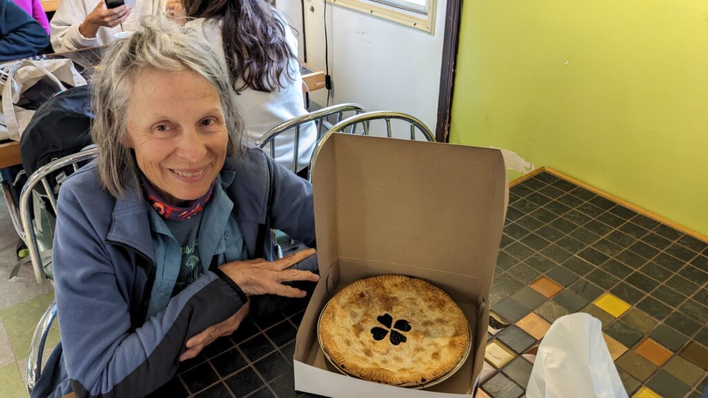
July 16-left Haines to drive north on yet another incredibly scenic highway to Kluane Nat’l Park in the Yukon Territory of Canada. Arrived in rain and awoke to rain next a.m. in Kluane’s main CG, Kathleen Lake, appreciating our warm, dry Casita! Rainy days are Visitor’s Center + museum days, sometimes bakery /brewery days which is how we found great sourdough bread at the Village Bakery in Haines Junction. (The bakery played a key role on my (KJ)’s birthday a few days later, when we returned for a rainy coffee to find a homemade blueberry-mixed-berry birthday pie surprise awaiting—courtesy of our sons!)
Spent the next few days under sunnier skies exploring the various glacier outwash plains and valley trails by mountain bike and foot. Kluane NP hosts Mt Logan, the highest peak in Canada at 19,551’ (5959m—2nd highest peak in N. America after Denali) and also the world’s largest non-polar icefield, which feeds over 2000 glaciers. We had to relearn what little glaciology we knew as we pedaled and hiked up wide, flat u-shaped valleys and up/down/through braided outwash plains a mile or more wide. Progress was slowed by KJ’s fascination with the variety and diversity of cobbles brought down from their source terranes by the glaciers.
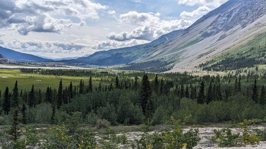
Alsek River U-Shaped valley, Kluane NP, YT. Ancient glacial lake terraces visible at base of talus slope, center right.
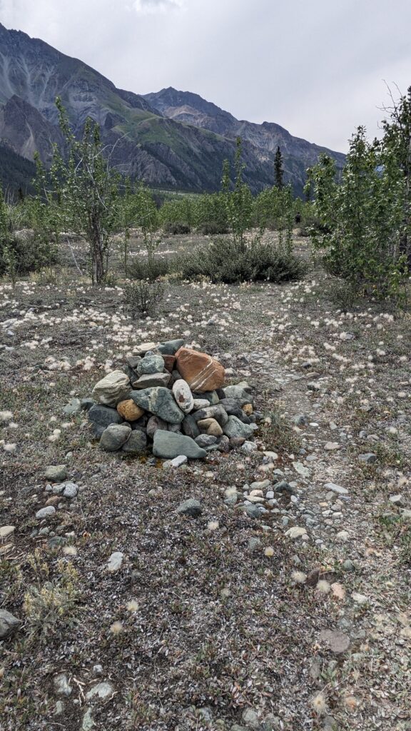
”Who’s Who of Rocks” represented in cairn, Vulcan Creek braided outwash plain, Kluane NP.
The Slims (A’ay Chu to the Kluane Lake First Nations people) River exiting the Kaskawulsh Glacier and once emptying into gigantic Kluane Lake hosts a side creek called Vulcan Creek. Pushing our bikes over its outwash plain, we noted cobbles of basalt, conglomerates, schists, sandstones, marble, etc, prompting Mike to call this outwash plain “a Who’s Who of Rock.” Soldier Point near the Thechal Dhal Visitors Center at Kluane Lake turns out to be the meeting point of the U.S. and Canadian crews building the Al-Can Highway. They completed their respective sections of the highway in an astonishing feat of international cooperation between Feb and Nov of 1942! The impetus was the U.S. Army’s concern about a Japanese attack somewhere on the west coast; they needed a quick west coast supply route in Alaska. Back to the natural world – A glacial-retreat-driven river-capture story that happened on the Slims (A’ay Chu) River in 2016 is severely impacting Kluane Lake and the First Nations people (Kluane / Southern Tutchone) and fishermen who depend on it. Glacial retreat of the Kaskawulch Glacier caused the ice dam below its toe to rupture in 2016. The glacial meltwater that had fed the northward-draining Kluane Lake (and eventually into the Yukon River and Bering Sea) was then diverted into the southward-draining Alsek River into the Gulf of Alaska. This massive drainage rearrangement has had far-reaching impacts, including causing the waters of Kluane Lake to drop precipitously, affecting the fisheries along its shores along with the fish populations, the vegetation and wildlife that depend on it such as Dahl sheep, deer, black and brown bear and causing silty sand dunes to begin forming at the inlet. This was an eye-opening learning to us regarding the impacts of climate change, as only glacial advance (ie, colder climate conditions) will permit the Kaskawulsh Glacier to again drain its meltwaters into shrinking Kluane Lake.
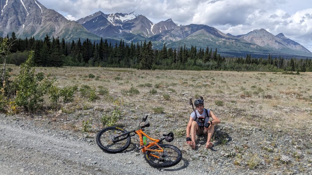
Alsek River valley, Kluane NP—mountain biked across outwash plains and rising creeks—which is why Mike needed to dry his feet!
Another learning the next day was around hiking/biking in glacial territory. We biked up the Alsek River Valley in Kluane, enjoying the roller coaster of bumping up and over glacial outwash creeks. Talking with locals a few miles up, we discovered that those tiny ribbons of water through which we’d merrily been splashing our bikes could turn into much much larger flows as the sunny day went on and glacial melt increased. We risked getting trapped upstream until evening (11pm!) when the cooling glacier slowed melting enough to allow us to pass. We stood on one outwash creek in the warm sun and watched as the creeks surged and increased their flow in real time! Ya don’t run into that problem in Colorado!
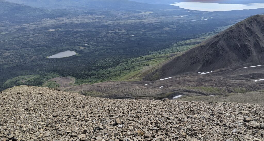
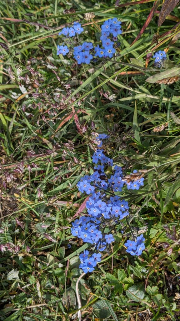
Finally, the King’s Throne Peak ‘death march’— one of the best and most rewarding but hardest hikes we did in Kluane departed from our Kathleen Lake CG. We biked the first 1.5 miles and then hiked the 2.5 miles and 4500’ of elevation gain (note that’s a 34.4% grade) to the truly epic views at the top. An 8-mile round trip hike isn’t too much until you factor in 1) a LOT of elevation gain on 2) steep slopes of crumbly, friable, unconsolidated ball-bearings masquerading as rock, 3) on a braided, fall-line ‘trail’ without a single switchback (Canadian trail-builders seem to detest switchbacks!) Six hours up, an hour admiring the view, 5 hours down, even with trekking poles. Views epic, such a clear day. Note Mt Logan 100 miles to west in photos. GEO-Notes: Part of the reason for the length of the hike was admittedly the fauna (les marmottes !), flora (gentian, forget-me-nots, cushion phlox, bluebells, lupine), but the geology, whoa: piles upon piles of mostly vertical, thin-bedded turbidites of the Jurassic Dezadeash Fm (says my RockD app). Well-exposed because much of the hike is above treeline, I could do detailed sedimentology (look it – an entire preserved Bouma sequence!) one minute, and large-scale structural geology the next (wow-a fault-bend fold, and the reverse fault broke through in the organic-rich mudstones!) All low-grade metamorphosed. Next up, we left Kluane July 23 to drive north on the Al-Can Hwy to Tok, AK.
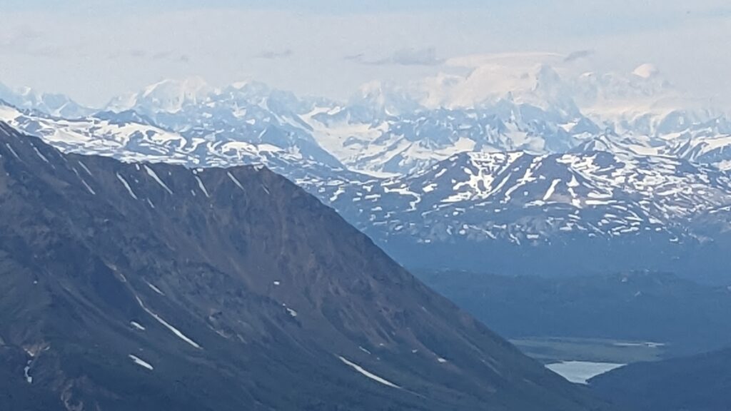
View from King’s Throne Peak (6529’) above Kathleen Lake in Kluane NP, YT, Canada. Mt. Logan (highest peak in Canada) massif in right center, ‘snowball’ peak at far right.
Multi-lobed “rock glacier” (yes, it’s a real thing!) on flank of King’s Throne Peak, Kluane NP. Note the flow-ey lobes!
Below — summit!
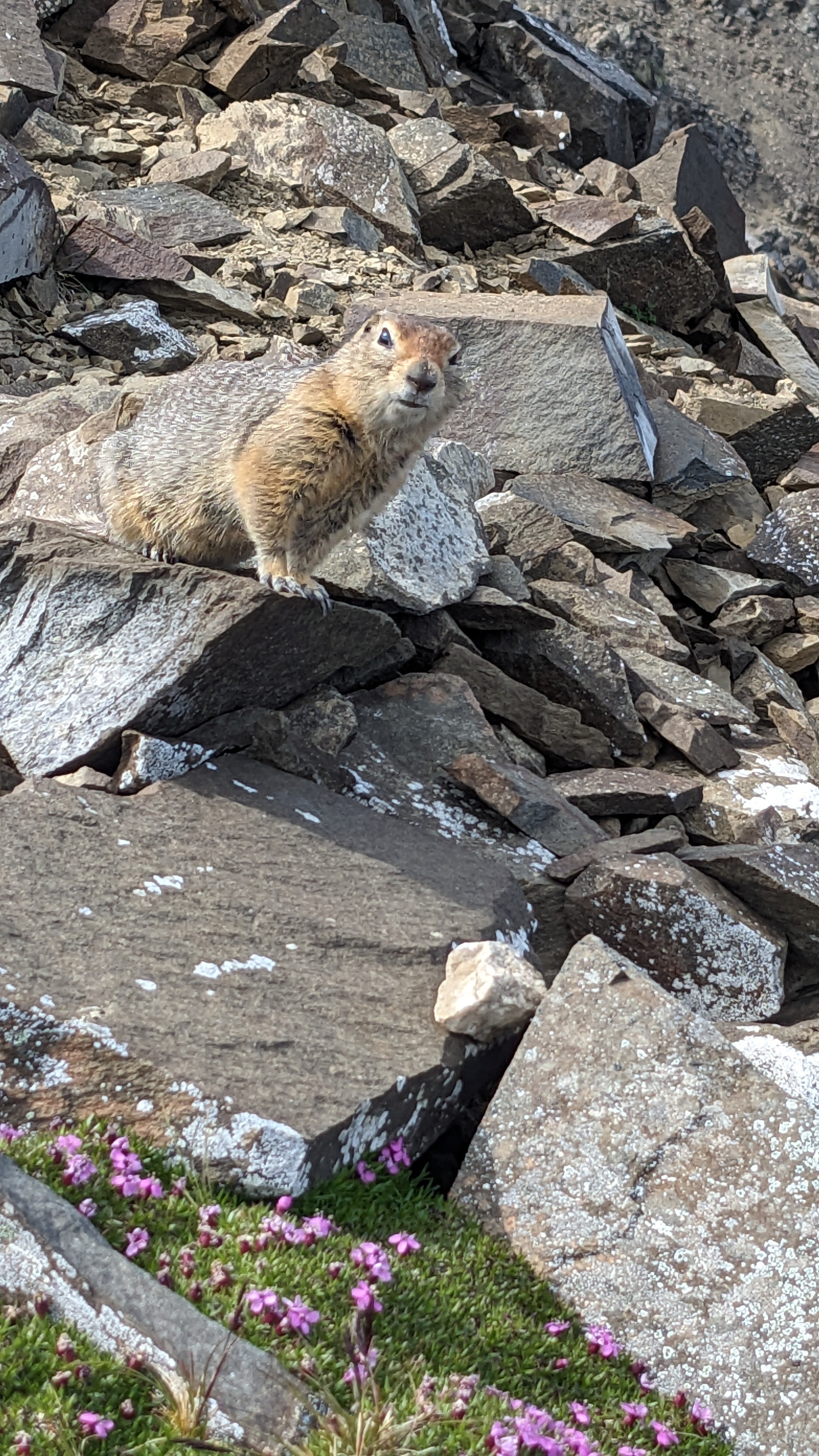
Photobombing marmot on my phlox pic!
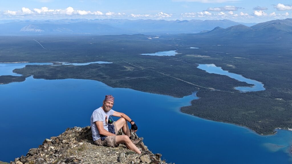
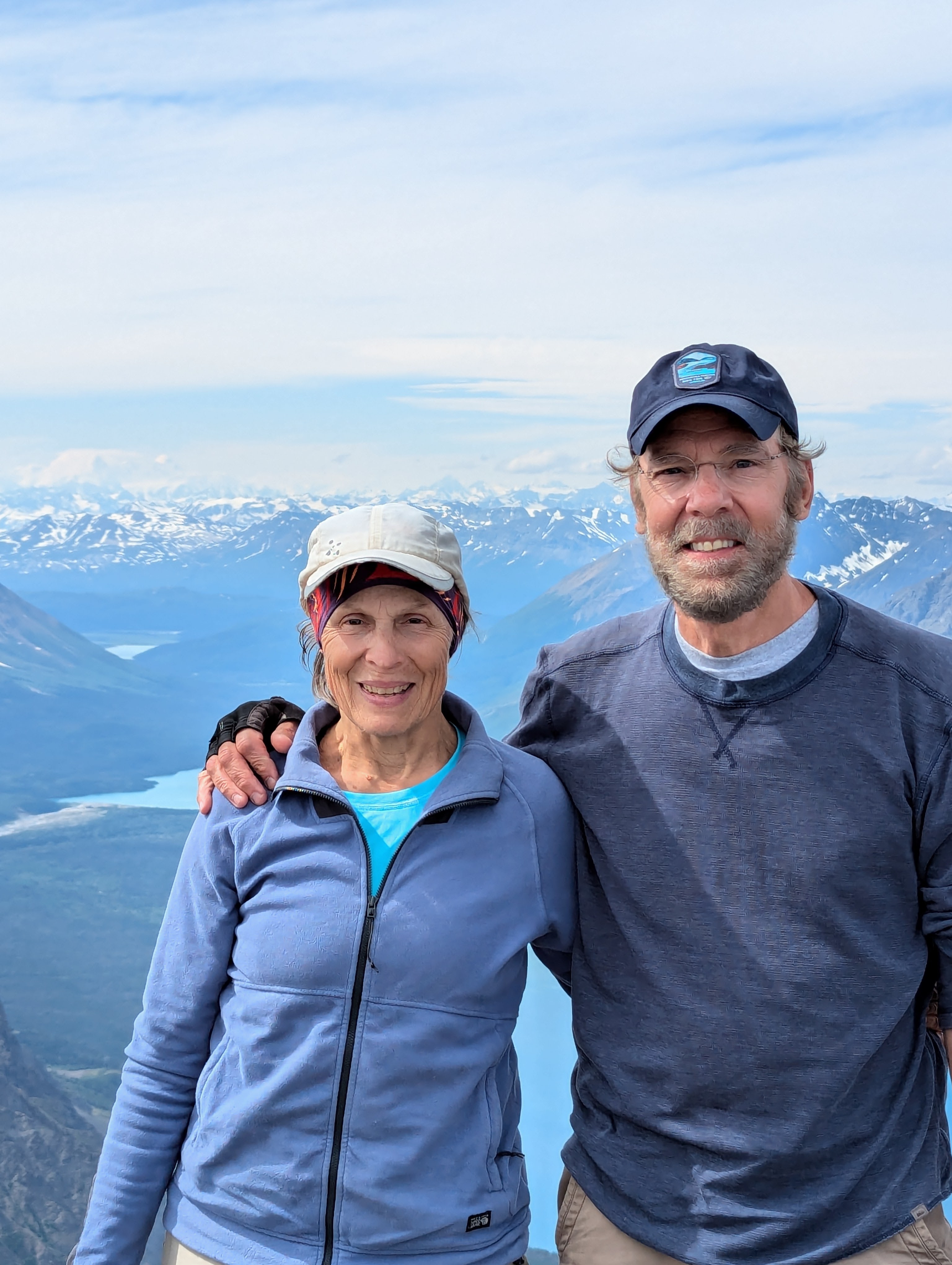
Mike above Kathleen Lake, Kluane NP en route to King’s Throne Peak.
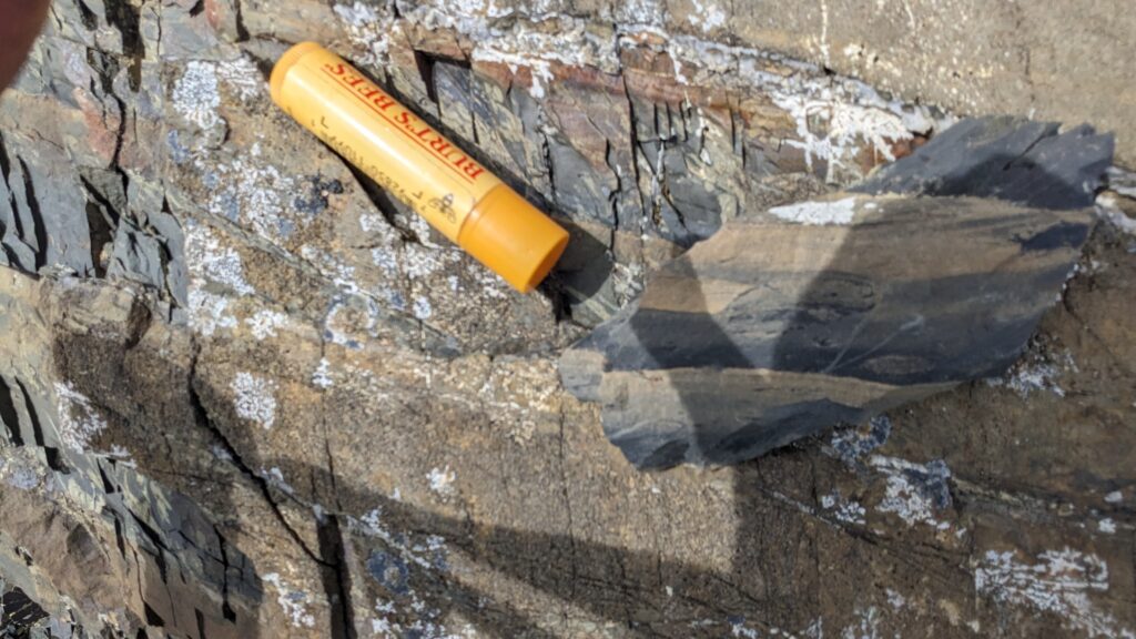
**Geo-shot alert** KJ’s always excited to find deep-sea sedimentary rocks high in mountain ranges—above 6000’ in this case. These fine-grained, slightly metamorphosed distal turbidite (likely) deposits comprise the Jurassic-Cret Dezadeash Fm of King’s Throne Peak. Chapstick scale is 2.75” (7cm) long.
Kluane NP & Reserve—never to be forgotten!
Next day on to Tok, AK across the enormous Tetlin Wildlife Refuge towards Wrangell-St. Elias NP and then on to Valdez via the Glenallen Highway.
Note — future posts will be mostly photos, less text. Adventures take time!